Instructor: Sibel Bozdogan and Cemal Kafadar
Course: STAGING THE CITY: URBAN FORM AND PUBLIC LIFE IN ISTANBUL
Students: Sera Tolgay and Maria Letizia Garzoli
Transformation and Persistence of Public and Private Edges along the Bosphorus Shoreline: Tracing the Spatial Genealogy of Ortakoy’s Waterfront from Head-Gardener’s Registers to Contemporary Plans
Different gradients of public and private ownership embody dynamics that shape the development of urban life and the public realm. Public and private spaces can be interwoven in complex configurations, underscoring the importance of ownership as a driver of spatial organization over time. The tension between public and private is particularly acute on the waterfront, where the edge between water and land complicates patterns of ownership. Following the founding of constitutional democracies in the first half of the 20th century, there has been a legal recognition of public access to the waterfront and the shoreline as a public realm. This is also the case in the Turkish Coastal Law of 1990, which codifies the use of coastal edges for “public benefit.” While there is a recognition of the public nature and use of coastal edges, complexity of ownership throughout history complicates this reality.
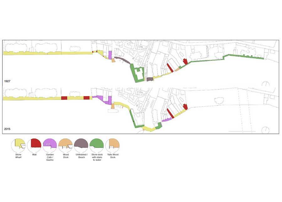
The aim of this research is to trace the spatial genealogy of Istanbul’s waterfront, particularly in Ortaköy, to understand the transformation and persistence of property ownership boundaries and determine the extent to which the public has been able to access the waterfront. Architectural historian Uğur Tanyeli argues that at least until the second half of the 19th century in Ottoman territories, there had been “a lack of separation of the world into private and public halves.” With the Bosporus coastline around Ortaköy as our main focus, we hope to test this claim by looking at a variety of primary sources, with Head-Gardener’s Registers from the Selim III and Mahmut II eras of early 19th century when this transformation begins and later the 1927 Pervititch insurance maps when the contrast between public and private becomes more apparent.
The importance of waterfront access is relevant today more than ever, with the redevelopment of numerous waterfront sites from the Haliç navy yards and Galataport further south in the Bosphorus to a new tourism development site in Ortaköy that was re-zoned in 2013. While the Gezi Park occupation disputed the commercialization of public space at the heart of the city, the waterfront as a public space has not been a prominent concern and has not been examined thoroughly. By tracing the spatial genealogy of the Bosporus waterfront, this research hopes to uncover evolving uses of the Bosporus shoreline, especially from late 18th century onwards, and illustrate the possibilities of using the waterfront as more of a connecting rather than a dividing edge.