Instructor: Eve Blau
Course: Reconceptualizing the Urban: Berlin as Laboratory
Students: Xiang Chang, Adam Himes, Aleksandra Kudryashova, Laurel Schwab
As part of the Harvard Mellon Urban Initiative-sponsored research seminar ‘Berlin as Laboratory’, students have conducted historical research of urban plans, maps, and projects and constructed a historical narrative through the mapping of spatial developments of the city’s history, divided into four periods the last of which implies a projection into the near future: 1650 – 1900, 1900 – 1945, 1945 – 1989, and 1989 – 2030.
—
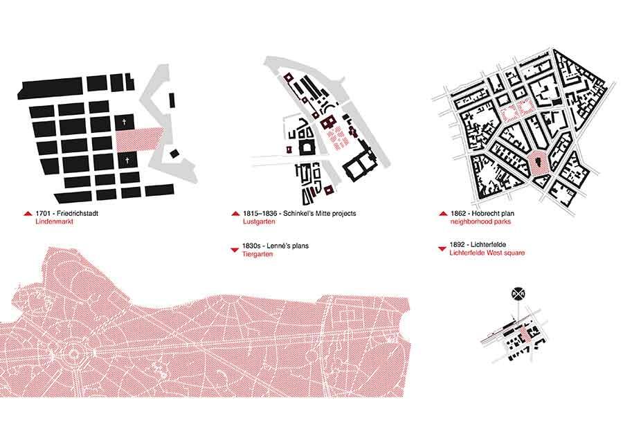
Public Space Comparison – A comparison of paradigmatic public spaces throughout Berlin’s pre- and early modern history, each in turn reflecting priorities of their time: commerce, state power, social equality, and the importance of industry, particularly the railroad.
Schinkel / Mitte – A map of Karl Friedrich Schinkel’s projects in Mitte, c.1841. The names of buildings that have not survived to the present have been crossed out.
Ünter den Linden – Berlin’s primary axis running west from the historical core, Ünter den Linden (highlighted in red) is a reverse-chronological timeline of the city’s development manifest in built form. The graphic above notes that plans were typically implemented by public authority, yet tinged by ideals of egalitarianism, until the advent of industrialization, which saw a shift toward private, class-oriented development.
Urban form – The railroad spurred private villa developments (right) in the verdant suburbs, sharply contrasting with the dense tenements of the preceding era (left).

